Where Is the Okavango Delta? Country, Map and Why It Is Not a National Park
The Okavango Delta lies in northwestern Botswana, where a river from Angola spreads across Kalahari sand and never reaches the sea. It is a UNESCO World Heritage Site, and it is not a national park.
Maun is the gateway for the reviewed delta trips. Compare the actual route and location, especially when a listing describes NG32 community camping. Explore Mokoro Day From Maun
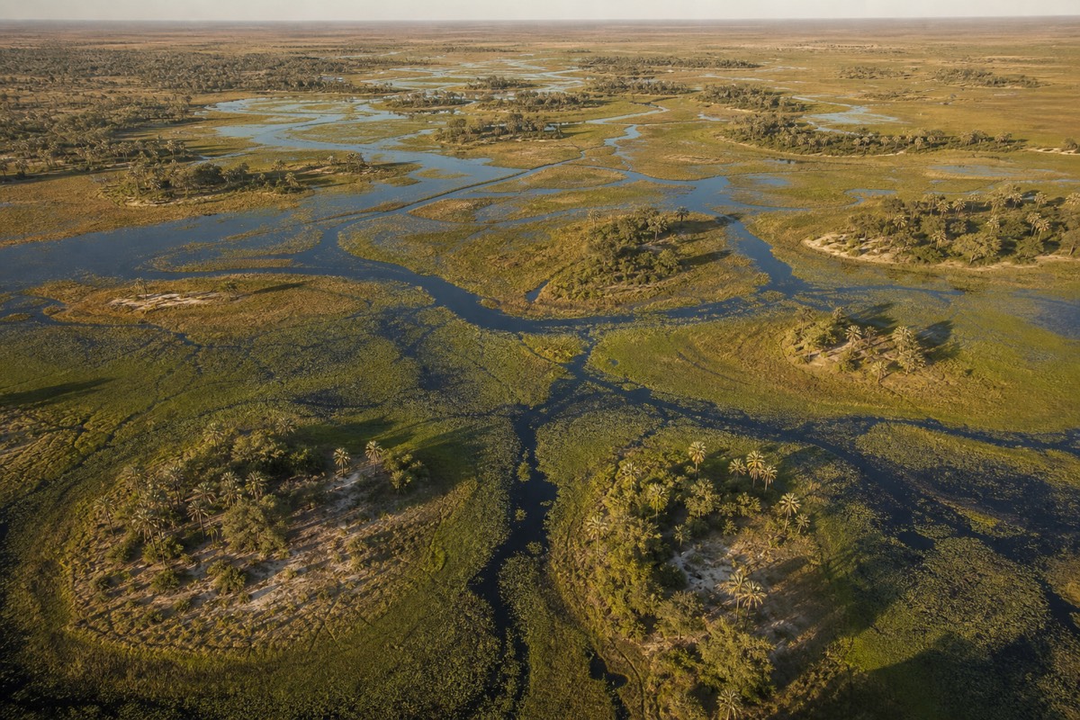
A few dozen people a month search for the Okavango Delta National Park. It does not exist. What exists instead is a flooded inland river system in northwestern Botswana, protected by one game reserve that a local community founded and a ring of leased concession blocks, with no gate to drive up to and no entry booth where you hand over a fee. That distinction is not pedantry. It decides how you get in, what you pay for, and which part of the delta you actually end up seeing. The team at Okavango Delta Botswana Tours fields this question more often than any other, so here is the whole geography in one place: the country, the borders, the size, the protected status and the airports.
What actually protects the Okavango Delta, and how it compares with the reserves around it
The 40 / 60 split is the shape of the protected-area mosaic inside the UNESCO-inscribed property, not a surveyed boundary line. Reserve sizes are the standard published figures for each area.
Which country is the Okavango Delta in?
The Okavango Delta is in Botswana, in the northwest of the country, in the Ngamiland district on the northern edge of the Kalahari basin. Botswana is landlocked in southern Africa. The gateway town is Maun, on the delta's southern rim, and the water that floods it falls as rain two countries upstream, in Angola. Almost every trip into the delta starts by flying to Maun, whatever the itinerary does afterwards.
Ngamiland is the district name you will see on Botswana government documents and on health advisories, and it is worth recognising because it is the administrative unit the delta sits inside. Most of the land here is tribal land rather than state land, which is the single fact behind everything else in this guide. It is not a wilderness the government fenced off. It is a working landscape whose use rights are allocated, and safari tourism is one of the uses.
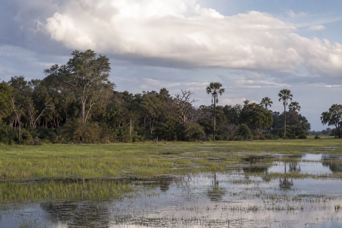
The geography reads as a contradiction until you see it. This is the Kalahari, a vast sand basin that gets its water from rain and holds almost none of it on the surface. Then a river arrives from the north and simply stops, spreading sideways instead of cutting a valley, and the result is thousands of square kilometres of channels, lagoons, reed beds and palm islands sitting on top of desert sand. Maun is the town where that switch happens, a dusty low-rise place with an airport, a lot of safari offices and very little else, and what to expect from Maun itself matters more than most first-timers assume, because nearly everyone spends a night there.
Which countries and places sit around the delta?
Botswana borders Namibia to the north and west, Zambia at a single point in the northeast, Zimbabwe to the east and South Africa to the south. Angola, the source of the delta's floodwater, is one country further north. Those borders are why the region sells as a circuit, and why our fifteen-day guided lodge tour across Namibia, Botswana and Zimbabwe exists at all. Victoria Falls sits northeast of the delta, on the Zambia and Zimbabwe border. Those relationships explain most of the region's multi-country safari routes.
The practical version of that map is short. Travellers arriving from Europe or North America almost always connect through Johannesburg in South Africa. Travellers combining the delta with Victoria Falls run east and north through Chobe. Travellers heading for the desert run south. The delta is the anchor, and the other destinations arrange themselves around it in a rough semicircle to the north and east, which is why the choice between Chobe and the delta comes up in almost every planning conversation rather than being a question of one or the other.
| Place | Where it sits | Why it matters for a delta trip |
|---|---|---|
| Maun, Botswana | Southern edge of the delta, about 65 km from the water | The gateway. Maun Airport (MUB) is where almost every delta itinerary begins |
| Angolan highlands | Upstream to the north, in Angola | Where the flood is born. The rain that fills the delta falls here from November to April |
| Namibia | North and west along Botswana's border | The river crosses Namibian territory on its way south into Botswana |
| Kasane and Chobe National Park | Northeast, served by Kasane Airport (BBK) | Botswana's elephant-and-river-cruise destination, and the usual second stop |
| Victoria Falls | Further northeast, on the Zambia and Zimbabwe border | The classic add-on. The site's 11-day route runs from the falls to the delta via Chobe |
| Central Kalahari Game Reserve | South of the delta, reached from Maun | Open desert grassland, a completely different ecosystem, three days from Maun |
| Johannesburg, South Africa | Far southeast, the main air hub | The usual connection point. Johannesburg to Maun runs about 1 hour 30 to 2 hours |
Distances and flight times above are typical planning allowances rather than a schedule; confirm timings against the airline on the day you book.
What kind of landform is an inland delta?
The Okavango is an endorheic, or inland, delta. A normal delta forms where a river meets the sea. This one forms where a river meets a flat sand basin and runs out of anywhere to go, so it fans into thousands of channels and disappears. Roughly 97 per cent of the water that arrives is lost to evaporation and transpiration.
About 11 cubic kilometres of water enter the system each year. Almost none of it leaves. Some trickles south into the Boteti River and the Makgadikgadi pans in exceptional years, and the rest goes up: into the air off open water, and through the papyrus, reeds and trees that pump it out of the ground and into the atmosphere. That is why the delta is fresh rather than brackish, and it is also why the whole system is so sensitive to what happens upstream.
The shape this produces is unusual enough that the UNESCO World Heritage listing for the Okavango Delta singles out the annual flood arriving in the dry season as the reason for inscription. A permanent core of channels and lagoons holds water all year. Around that core, seasonal floodplains fill and empty on an annual rhythm, and beyond them the sand simply resumes. Sit low in a dugout canoe at the edge of a floodplain in August and you can see both at once: water to the horizon in one direction, dry Kalahari scrub a few hundred metres away in the other.
How big is the Okavango Delta?
The flooded area swings from roughly 6,000 square kilometres in the dry months to about 15,000 square kilometres at peak flood. The UNESCO-inscribed property covers 2,023,590 hectares. Both figures are correct, because the delta is not a fixed shape. It breathes on an annual cycle, roughly tripling the extent of its channels.
This is why published size figures for the delta disagree with each other so freely. Some sources quote the permanent wetland, some the peak flood extent, some the inscribed property, some the whole Okavango basin including the catchment in Angola. None of them are wrong. They are measuring different things. When a camp brochure says the delta covers 15,000 square kilometres, it is quoting the high-water number, which is the one that matters if you came for water activities.
| Measure | Figure | What it describes |
|---|---|---|
| Dry-season flooded extent | About 6,000 km2 | The permanent channels, lagoons and core wetland that hold water year round |
| Peak-flood extent | About 15,000 km2 | The full spread once the Angolan flood arrives, typically July and August |
| UNESCO inscribed property | 2,023,590 hectares | The World Heritage boundary, which includes land as well as water |
| Annual water inflow | About 11 km3 | What the Okavango River delivers into the system each year |
| Water lost inside the delta | About 97 per cent | Evaporation and transpiration, rather than outflow to a sea |
| UNESCO listing | Site 1432, inscribed 2014 | The 1,000th site ever inscribed on the World Heritage list |
Extent figures are the typical annual pattern rather than a measurement for any single year; the flood varies in both size and timing.
Is the Okavango Delta a national park?
No. There is no Okavango Delta National Park and there never has been. Moremi Game Reserve, which covers roughly 40 per cent of the inscribed property, is a game reserve rather than a national park. Everything around it is a mosaic of Wildlife Management Areas and leased concession blocks on tribal land.
The confusion is understandable, because every other famous African wilderness of this size is a park. Kruger is a national park. The Serengeti, the plains destination most often weighed against the delta in a Botswana or Tanzania safari comparison, is a national park. Chobe, an hour's flight northeast, is a national park, and Botswana's first, gazetted in 1967. The Okavango went a different way, and the story is worth knowing because it explains the whole visitor economy here.
Moremi Game Reserve was established in 1963 by the Batawana people, through their own tribal authority, on their own land. It was one of the first protected areas in Africa created by a local community rather than by a colonial administration, and at roughly 5,000 square kilometres it is not small. Beyond its boundary, the land is held as Wildlife Management Areas, subdivided into concession blocks with names like NG32, and those blocks are leased to community trusts and private safari operators. The land itself is administered by the Tawana Land Board. What that means is that the delta is not one property with one owner and one gate. It is dozens of leaseholds, each with its own rules, its own camps and its own vehicle limits. If you want the reserve itself rather than the concessions, Moremi Game Reserve has its own guide covering access, gates and what the reserve does that the concessions do not.
| Area | Status | Size | Who controls access |
|---|---|---|---|
| Moremi Game Reserve | Game reserve, established 1963 | About 5,000 km2 | Government wildlife department, public gates, self-drive possible with a 4WD |
| Wildlife Management Areas and NG concession blocks | Leased concessions on tribal land | The remainder of the inscribed property | The leaseholder. Access is by booking a camp or a trip, not by driving in |
| Community trust concessions, for example NG32 | Community-held lease | Block by block | The community trust, for example the Okavango Mokoro Community Trust |
| Chobe National Park | National park, established 1967 | 11,700 km2 | Government wildlife department, public entry, separate destination |
| Central Kalahari Game Reserve | Game reserve, established 1961 | 52,800 km2 | Government wildlife department, one of the largest reserves on earth |
Status and size figures above are the standard published values for each area; boundaries and lease arrangements change, so treat the table as orientation rather than a legal description.
For the formal record on Moremi, including its gazetting history, the reference entry for Moremi Game Reserve is a reasonable starting point.
What does the concession system mean when you actually try to book?
It means access to most of the delta is bought as a package, not as a ticket. A concession leaseholder decides how many beds and how many vehicles operate on its block, so the way in is to book a camp, a mobile safari or a community trip that already holds rights there. There is no queue to join at a gate.
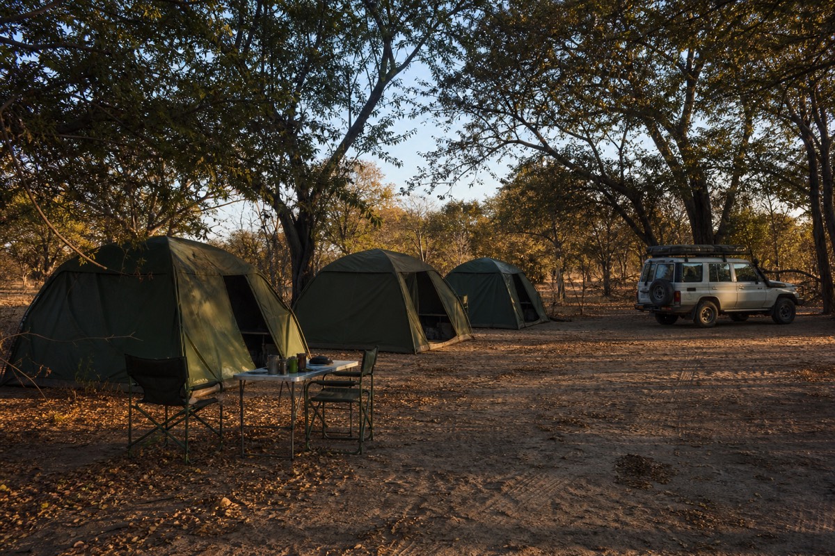
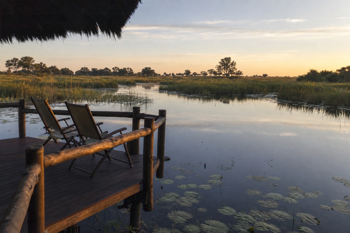
Three consequences follow, and they surprise people. The first is that the delta is quiet even in its busiest month. The whole delta carries roughly 1,000 to 1,500 beds across every private concession and camp combined, which is fewer guests than a single large hotel in a capital city, spread across an area the size of a small country. On a three or four hour game drive in a private concession you might see one or two other vehicles, or none.
The second is that sightings behave differently. Concession agreements cap the number of vehicles allowed at a sighting, usually two or three. When a guide finds lions on a morning drive, the vehicle can stay for as long as the animals are doing something interesting, instead of moving on to make room. That single rule is the difference between watching a hunt develop and photographing a lion through a gap between other vehicles.
The third is the one nobody enjoys hearing: this model is why the delta is expensive. Low density is not a marketing position here, it is a licence condition, and low density with high fixed costs means high prices. We set out the real numbers in the guide to what an Okavango Delta safari costs, including what the all-inclusive packages actually bundle.
Where does the water come from, and how far does it travel?
The water falls as rain in the Angolan highlands between November and April. It gathers into the Cubango and Cuito rivers, which join to form the Okavango, and the flood pulse travels roughly 1,200 kilometres south and east to reach Botswana. The river system runs about 1,500 kilometres in total and never reaches an ocean.
The two Angolan tributaries behave differently, which is part of why the delta's flood is a slow swell rather than a flash. One drains faster off harder ground, the other filters through deep sand and peat and releases its water gradually over months. By the time the pulse crosses into Botswana it has flattened into something closer to a tide than a flood, rising a few centimetres a day and taking weeks to work its way from the top of the delta down through the channel system to the southern floodplains.
| Stage | Where | When | What happens |
|---|---|---|---|
| Rain falls | Angolan highlands | November to April | The wet season in the catchment, far outside Botswana |
| The pulse forms | Cubango and Cuito rivers | Through the Angolan wet season | Two tributaries, one quick and one slow, merge into the Okavango River |
| The journey south | Roughly 1,200 km of river | Several months in transit | The flood crosses into Botswana having flattened into a slow swell |
| Arrival in the delta | The top of the fan, northern Botswana | May and June | Channels fill, floodplains start to spread sideways |
| Peak flood | Across the whole delta | July and August | Maximum water extent, up to about 15,000 km2 |
| The water disappears | Into the air, across the delta | Continuously | About 97 per cent evaporates or transpires rather than flowing out |
Timings are the typical pattern; the arrival and peak shift by several weeks from one year to the next.
Why is the delta at its fullest in the middle of the dry season?
Because the rain that fills it falls in another country, six months out of phase with Botswana's own. Angola's wet season runs November to April, and its water reaches Botswana in May and June and peaks in July and August, which is the middle of Botswana's dry winter. Botswana's own rains fall November to April, when the delta is at its lowest.
Two rainy seasons, six months apart, is the single most counter-intuitive thing about this destination and the reason so much planning advice about the delta reads backwards. The dry season is the water season. The wet season is the low-water season. Peak flood coincides with cloudless skies, cold mornings, no rain and animals concentrated on the few remaining permanent channels, which is a combination almost no other safari destination can offer at the same time.
It also means the flood does not run to a timetable. It arrives earlier or later by weeks depending on what Angola did the previous summer, which matters if your trip depends on water depth in a particular channel. The month-by-month picture, including which weeks are safe to build a canoe-dependent itinerary around, sits in our month by month guide to the best time to visit the delta.
Which airport do you fly into for the Okavango Delta?
Maun Airport, code MUB, on the southern edge of the delta. It is the base for almost every safari operation here and the departure point for the light aircraft that fly into the concessions. Kasane Airport, code BBK, in the far northeast, serves Chobe rather than the delta.
Maun is served by Air Botswana from Gaborone and Kasane, by Airlink from Johannesburg and Cape Town, and by CemAir from Johannesburg. The Johannesburg leg is the workhorse: about 1 hour 30 to 2 hours, and the flight most long-haul travellers connect onto. Gaborone to Maun runs about 1 hour 20. Nobody flies to the delta directly, because the delta has no airport. It has bush airstrips, reached from Maun in a six to twelve seat aircraft.
| Route | Typical flying time | Carriers | What it gets you |
|---|---|---|---|
| Johannesburg to Maun (MUB) | About 1h30 to 2h | Airlink, CemAir | The standard international connection into the delta |
| Cape Town to Maun | Longer, one stop typical | Airlink | Useful if you are already touring South Africa |
| Gaborone to Maun | About 1h20 | Air Botswana | The domestic route from Botswana's capital |
| Kasane (BBK) to Maun | Short regional hop | Air Botswana | Links the Chobe side of the country to the delta side |
| Maun to a delta airstrip | 20 to 45 minutes | Charter operators including Mack Air, camp-provided flights | The last leg into the concessions, usually bundled into a camp package |
Schedules and carriers change season to season; treat this as a planning sketch and confirm with the airline. Botswana's official tourism body publishes current arrival information at the Botswana Tourism Organisation site.
Inner delta or outer floodplain: which part will you actually see?
The inner delta is the permanent channel system reached by light aircraft, or by canoe through several channels from the edge. The outer floodplain is the road-accessible fringe within a few hours of Maun. Both are genuinely the Okavango, but dry-season wildlife density is markedly higher in the inner delta, and which one you get is decided by how far ahead you book.
This is the distinction that separates a creditable safari from an exceptional one, and the site has always been blunt about it. In the inner delta during the dry months, elephants move between islands in herds of 50 or more, lions hunt along the floodplain edges at dusk, and African wild dogs, one of the continent's most endangered mammals, range across Moremi and Khwai. The road-accessible outer areas are less pristine and less reliable for predators. Nobody is being short-changed on a day trip from Maun, but they are seeing a different thing.
| Inner delta | Outer floodplain | |
|---|---|---|
| How you reach it | Light aircraft from Maun, 20 to 45 minutes, or several channels by canoe | Road transfer from Maun, then a short water leg |
| Typical stay | Three nights and up, in a concession camp | A day trip, or one to two nights of island camping |
| Dry-season wildlife density | The highest concentrations in the system | Good, less reliable for predators |
| Lead time needed | Months for peak season, longer for the best camps | Days in the shoulder months, weeks in peak season |
| What it costs | Multi-day package territory | Day-trip and short-camping territory |
Wildlife density is a pattern, not a promise; no operator can guarantee a sighting anywhere in the delta.
There is a third way to understand the geography, which is to see it from the air without landing. A 45-minute scenic flight over the delta from Maun shows the whole structure in one sweep: the channel maze, the permanent and seasonal islands, elephant herds as grey shapes in shallow water, and the hard line where floodwater meets Kalahari sand. It is expensive for its length and it lands you nowhere, but nothing else makes the shape of the place legible so fast.
How do you cross the last stretch from Maun into the water?
Three ways: a charter flight of 20 to 45 minutes to a bush airstrip, a guided road transfer of one to four hours followed by 30 minutes to two hours by boat or canoe, or a self-drive in a high-clearance 4WD to a public launch point. Maun sits about 65 kilometres from the delta's edge, and almost nobody covers that last stretch on tarmac.
Charter is the standard for the luxury camps and is normally written into the package rather than bought separately, at USD 200 to 600 per person one way, with round trips often cheaper and shared charters cheaper again. The guided road and water transfer is the standard for mid-range camps, at roughly USD 150 to 400 per person round trip when bought on its own. Self-drive works only for travellers who genuinely have 4WD sand and river-crossing experience, and it limits you to public access points such as Xakanaxa or the polers' trust near Mababe Gate, where a canoe with a poler runs about USD 50 to 100 a day. The full comparison, including what can go wrong on each, sits in our note on getting from Maun into the delta.
| Route in | Time | Standalone cost guide | Best for |
|---|---|---|---|
| Charter flight to a bush airstrip | 20 to 45 minutes | USD 200 to 600 per person one way | Inner-delta concession camps, usually bundled into the package |
| Road transfer plus boat or canoe | 2 to 6 hours in total | About USD 150 to 400 per person round trip | Mid-range camps and community camps on the accessible side |
| Self-drive plus public canoe | 2 to 5 hours driving, then 1 to 3 hours on the water | Fuel, plus about USD 50 to 100 a day for canoe and poler | Experienced 4WD travellers with time and their own kit |
| Day trip from Maun | A full day, out and back | Sold as a package from the town | Travellers with one day, who want the water rather than the camps |
Costs above are the ranges the operators we work with quote for standalone transfers; the live listing carries the current figure for any packaged trip.
The last leg is very often a mokoro, the flat-bottomed dugout canoe poled from the stern, and it is worth understanding how a mokoro actually works before you sit in one, because passengers sit inches above the water and the channels are frequently narrower than the boat is long.
How does the delta fit with Botswana's other wilderness areas?
The delta is the wetland. Chobe National Park, 11,700 square kilometres in the northeast, is the elephant and river-cruise destination. The Central Kalahari Game Reserve, 52,800 square kilometres to the south, is open desert grassland and one of the largest reserves on earth. They are different ecosystems, and the good itineraries treat them that way.
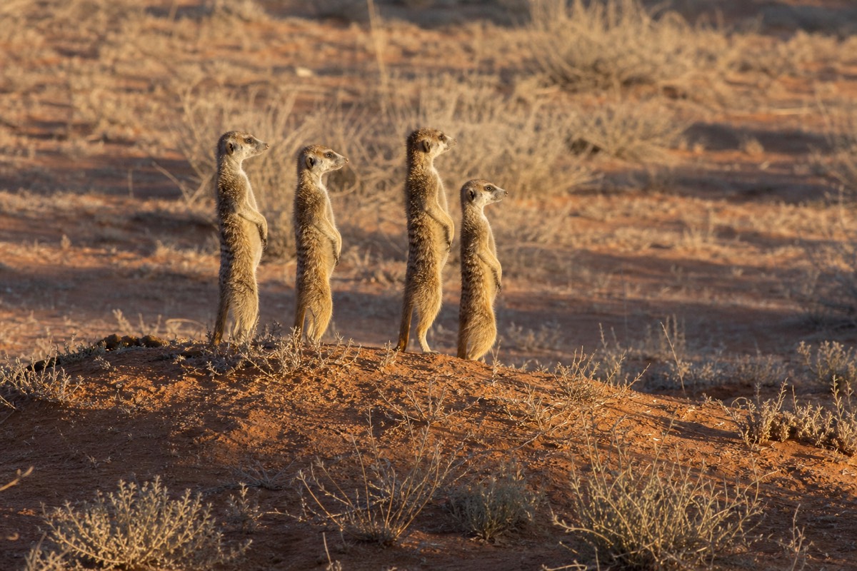
Chobe's elephant population is commonly estimated at around 50,000, and its signature activity is a boat cruise on the Chobe riverfront rather than a canoe in a channel. It reads as a natural pairing with the delta, and it is, provided you give each one enough nights. The Central Kalahari runs on the opposite calendar to the delta: it is at its best in the green season, roughly December to April, when rain flushes the Deception Valley grasslands and the plains game and black-maned lions follow. That inversion makes the Central Kalahari a genuine green-season alternative rather than a consolation prize, and it is why a three-day desert trip out of Maun sells well in exactly the months when the delta's water is low.
The mistake we see most often is compression. Trying to fit the delta, Chobe and Victoria Falls into four days produces a travel schedule rather than a safari, because two of those days become transfers. The delta rewards nights spent in one place: two game drives a day, a canoe or a walk in between, and enough time for the guides to work a territory rather than sprint through it.
What we tell first-timers who are placing the delta on a map
Fly to Maun, decide whether you want the inner delta or the accessible fringe, and book early enough to get the one you chose. That single decision matters more than which camp brand you pick, and it is the one that closes first, because capacity here is capped by conservation licence rather than by demand.
In practice the calendar does the deciding. July, August and September are the hardest months to find space in, and the good concession camps and the community canoe camps are allocated many months ahead. The 45-minute scenic flight fills in July and August too. April to May and November to December are the windows where same-day and next-day bookings in Maun are realistic, which is genuinely useful if your plans are loose.
What our trips bundle is the awkward part: the charter or road transfer, the park fees, the camp, the guiding and the meals in one price, which is exactly the set of pieces that becomes hard to assemble late. If you want the concession side of the delta with the vehicle caps and the low density, four days in private concession camps is the shortest format that delivers it properly. If you want the water and the silence for a fraction of that, a full day on the water with community polers does more than its price suggests. Either way, the geography lesson has a practical ending: there is no gate, so the booking is the gate.